Our Researchers

Seafloor and Habitat Mapping, Ocean Characterization, Spatial Ecology, Acoustic Surveying, Image Analysis, Photogrammetry, Ocean Technology
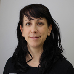
Dr. Robert holds an MSc from the University of Victoria, BC, and a PhD from the University of Southampton, National Oceanography Centre, UK.
With research focusing on seafloor and habitat mapping, Dr. Robert aims at improving our understanding of species-environment relationships. Her main data collection tools are cameras and sonars, and she has primarily worked with benthic megafauna and cold-water corals in the deep sea.
Dr. Robert’s favorite part of research is going out at sea as she has had numerous opportunities to participate in research cruises in the Atlantic and Pacific Oceans as well as the Mediterranean, and has worked with ROVs, AUVs and the manned submersible Alvin.
Research Program
The ocean contributes significantly to Canada's economy, yet less than 10% has been adequately mapped and the spatial distribution of most species is not well understood.
The 4D OCEANS Lab's research focuses on mapping the spatial complexity of the ocean from the seafloor to the surface. Our focus is to create an integrated picture of our oceans, which will allow us to understand the relationships between habitats, resources, human activities and changing conditions.
Our research aims at advancing our understanding of spatio-temporal heterogeneity, distributions of benthic communities, how habitats may respond to different human-induced and natural stressors, and how scale (extent and resolution) affects our ability to detect and monitor change. We employ a range of technologies (AUVs, ROVs, sonars, photogrammetry) to provide high-resolution maps from which quantitative insights regarding resource location, infrastructure condition, geological hazards, local oceanographic processes or effectiveness of conservation measures can be drawn.
Specific aspects of our research include:
- The development, optimization, and implementation of a multi-scale mapping framework for robust monitoring of both economically- and ecologically- valuable habitats.
- The implementation of automated classification techniques and predictive models as a cost-saving tool to target areas of interest, minimize environmental impacts, and quantitatively monitor change.
- The production of maps that represent the marine environment in four dimensions; integrating the surface, water column, and seabed to better characterize ocean heterogeneity in both space and time.
To inquire on future opportunities contact Dr. Robert.
Significant Publications:
Lo Iacono C, Robert K, Gonzalez-Villanueva R, Gori A, Gili J-M and Orejas C (2018) Predicting cold-water coral distribution in the Cap de Creus Canyon (NW Mediterranean): Implications for marine conservation planning. Progress in Oceanography, 169: 169-180.
Ismail K, Huvenne VAI and Robert K (2018) Quantifying Spatial Heterogeneity in Submarine Canyons. Progress in Oceanography, 169: 181-198.
Carter GDO, Huvenne VAI, Gales J, Lo Iacono C, Marsh L, Ougier-Simonin A, Robert K and Wynn R (2018) Ongoing evolution of submarine canyon rockwalls; examples from the Whittard Canyon, Celtic Margin (NE Atlantic). Progress in Oceanography, 169: 79-88
Victorero L, Robert K, Robinson LF, Taylor ML, and Huvenne VAI (2018) Species replacement dominates megabenthos beta diversity in a remote seamount setting. Scientific reports, 8: 4152.

