
Ocean Mapping
Ever wonder what lies beneath? Want to map the unknown? Discover your inner explorer and unlock the mysteries of the ocean.
Offshore and onshore data processing, analysis, management and dissemination.
Program Location:
Marine Institute Campus, Ridge Road (St. John's)
Program Length:
Four years with option to exit at 3 years with Diploma of Technology
Courses:
Practical Experience:
Three technical sessions and one work term
Application Deadline:
Fall Admission:
April 15 (Fall). Applications received after this date will be assessed as resources and space allow.
For More Information:
2023-2024 Undergraduate Viewbook
In the program you'll cultivate solid technical skills to collect, manage, analyze and disseminate ocean data.
You'll be trained in marine surveying equipment, optical and acoustic remote sensing technologies, oceanographic instrumentation and geographic information systems. By the end of the program, you'll have had the opportunity to delve deep into the ocean to examine the ocean using industry-drive acoustic technology and leading edge software applications.
This program consists of six in-class semesters, three technical sessions and a work term. In the fourth year, students continue with Bachelor of Technology courses with an option to exit at 3 years with Diploma of Technology.
Adherence to our Application and Admission Regulations either upon high school graduation (following a period of employment subsequent to graduation), or by transfer from another post-secondary institution.
Proof of physical fitness must be provided by way of a signed Transport Canada Seafarer's medical from an approved physician.
Application and admission to Memorial University for relevant courses at the beginning of the first technical session.
"The skills and knowledge gained from this program open so many doors in the field of Ocean Mapping. From mapping seamounts off the coast of Mexico, exploring the icy waters of the Arctic, or charting the coastal shores of Newfoundland, this program will take you there. Go explore our oceans; MI will help make it possible!"
- Sarah Walsh, MI Graduate
- Marine Institute's Ocean Mapping - Diploma of Technology/Bachelor of Technology is a Technology Accreditation Canada (TAC) accredited program at the technologist level.
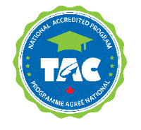
- National program accreditation involves an independent team of certified professionals performing an extensive audit, which provides graduates and employers confidence the program meets the educational standards of Canada's engineering technology and applied science profession.
- Graduating from a national accredited program creates an expedited path to becoming a certified professional with provincial certifying bodies in Canada.
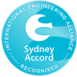
- Marine Institute's Ocean Mapping - Diploma of Technology/Bachelor of Technology is a national accredited program recognized by the International Engineering Alliance under the Sydney Accord.
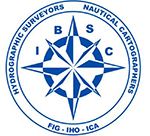
The Ocean Mapping program has successfully attained international recognition under the International Hydrographic Organization (IHO) as a Category B Hydrographic Surveyor program, making the program accepted and recognized worldwide.
![]()